


Boat NAVI

Description of Boat NAVI
Please try "Boat NAVI", when you do fishing by a boat.
Of course, It is convenient also when enjoying the sailboat which does not do fishing, and the cruise of a small ship.
"Boat NAVI" is an application which assists your boat fishing with Google Map and GPS data. You can save your known fishing points, and boat tracking line, with GPS data and date time. And, "Boat NAVI" navigates you to the saved point at next time. Let's teach your friend the saved point which can be fished ,using "Boat NAVI".
This application was created by 'Kei Nakazawa (uncle Kei)'.
I am a boat fishing reporter of "TURI JYOHO" which is a Japanese fishing magazine.
http://tj-web.jp/
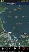
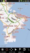
1. It is the application which used Google MAP as the base.
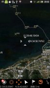
2. Tracking, such as trolling, is recordable.
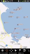
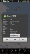
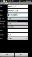
3. The point which was able to be fished can be registered.
Depth of water, sea bottom types, and a fish stock are also recordable.
4. Other marks can also be registered.
5. The display of a direction can be performed.
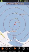
6. A concentric scale can be displayed.
7. The data registered into next time can be referred to.
version 1.7
1.You can set font size.
version 1.5
1. Improvement of imaging speed.
2. Display of boat fishing spot (only in Japan).
To edit fishing spot, wait next version. sorry.
3. Edit of Tracking Name
version 1.4
1. The form of the self-ship was used as the arrow type.
2. Improvement of display Speed.
3. A marker can be inputted into the cursor position.
4. The position of a marker can be edited.


